 F-2 MISSIONS
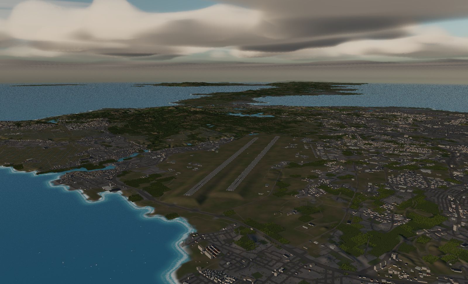
Kadena Air Base
Two runways of 3,688 m — the longest and the southernmost terrain in the game. West of the pavement, coral shallows all the way out.
DATA
- Identifier
- RODN / Kadena Air Base
- Runways
- RWY 05L/23R — 3,688 m × 91 m
RWY 05R/23L — 3,688 m × 91 m - Elevation
- About 40 m
- Based units
- United States Air Force, 18th Wing
(KC-135, E-3, HH-60 and others) - Area built
- 17.5 km square
- Buildings
- 29,562
The longest runway in the game, and there are two of them. It is also the southernmost ground here.
The real base
Kadena, Okinawa City and Chatan, Okinawa prefecture. Home of the USAF’s 18th Wing, one of the largest air bases in the Far East, with two parallel runways of 3,688 m × 91 m.
Two squadrons of F-15C/D were based here for decades before being retired, and F-15EX aircraft have been reported as their replacement. KC-135 tankers, E-3 airborne warning aircraft and HH-60 rescue helicopters also operate from the field.
The terrain we built
17.5 km square, spanning the central waist of Okinawa — sea on both sides.
The water to the west does not look like the water anywhere else in the game. Coral shallows form a turquoise band along the shore before the bottom drops away and the colour goes to deep blue. There are 29,562 buildings, and as in life the base is completely surrounded by the city.
What it is like to fly
3,688 m. With that much pavement, neither the take-off nor the landing is about whether the distance is enough. It is the most forgiving runway in the game.
Which leaves the view as the main event. Take off from RWY 05, turn left, and the whole windscreen fills with shallow-water blue. At 26.4° north — more than sixteen degrees south of Chitose — the sun sits at a different height and rises and sets on a different bearing than anywhere else here.
Try not to stare at it.
The terrain included varies by edition and platform. See the description of each edition for details.
Elevation data: Geospatial Information Authority of Japan (GSI)